
Thursday, October 11, 2012

Soil
The Virgin Island’s soil is a
complex tropical volcanic soil. The National Department of Agriculture classified it as victory soil. Victory soil forms on side slopes in
volcanic areas in tropical climates and is considered an inceptisol. The O
horizon is relatively shallow. The yellow and brown loamy A horizon extends
about eleven inches underground before it hits the B Horizon extending nine
inches further before it hits the weathered rock of the C horizon, which
extends thirty inches to igneous parent rock.
Victory soil of the Virgin Islands has the typical chemical properties for tropical islands. The soil has an acidic PH and a superactive CEC (Cation Exchange Capacity) meaning that plants can easily soak up nutrients due to a high amount of soil colloids that promote CEC.
Victory soil of the Virgin Islands has the typical chemical properties for tropical islands. The soil has an acidic PH and a superactive CEC (Cation Exchange Capacity) meaning that plants can easily soak up nutrients due to a high amount of soil colloids that promote CEC.
The pedogenic process that seems to be occurring is Laterization. Since the soil content has a high percentage of sand and rock, the soil is very permeable allowing water to drain rapidly. This heavy drainage leads to eluviation and leaching that washes away nutrients. Plants suck up leftover nutrients that are not washed away. This leaching is what gives the soil its acidic PH, because the drainage washes away base cations (Pidwirny).
Santiago, Carmen. "VICTORY:
the Representative Soil of the U.S. Virgin Islands." Natural Research
Conservation Service. USDA, 12/16/2011. Web. 11 Oct 2012.
<http://www.pr.nrcs.usda.gov/technical/soil_survey/vistsoil.htm>.
Pidwirny, Michael.
"Soil." The Encyclopedia of Earth. Environmental Information
Coalition, 07/5/2011. Web. 11 Oct 2012.
<http://www.eoearth.org/article/Soil>.
Wednesday, September 19, 2012
Creation
To
understand how the Virgin Islands were created it is necessary to
understand the plate tectonics underneath them. The Virgin Islands are located
along the northern edge of the Caribbean plate, where it meets the North
American Plate. These plates are moving west at different speeds. North
American Plate is moving at a faster rate creating a convergent boundary
causing subduction (Joyce, 5). Evidence of this subduction is the Puerto Rican Trench that
runs parallel to the Virgin Islands. As the North American Plate sunk below the
Caribbean plate energy was released melting parts of the upper mantle into
magma. This allowed it to form laccoliths that pushed land up and expose the
Virgin Islands from the sea.
Evidence
of the tectonic birth is all over the Virgin Islands. The location of the
islands in relation to the Puerto Rican Trench is a great example of a subduction
zone. The effects of subduction gave the islands some unique features. As magma
cooled and solidified, erosion revealed plutons. On the island Virgin Gorda one
of the main attractions is The Baths, which are batholiths or a collection of
plutons.

Wednesday, August 29, 2012
Intro
My name is David Ray and I am a geography major at UCD. I created this blog in order to teach readers about the physical geography in the Virgin Islands. I had a few other places in mind for researching, but my history and interests in the Virgin Islands made it stand out the most.
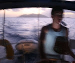
After high school I spent a little over a week sailing around the islands mostly on the British side. From the location, climate and geological makeup I experienced in the virgin Islands I know it will be a unique place to research and share about.
After high school I spent a little over a week sailing around the islands mostly on the British side. From the location, climate and geological makeup I experienced in the virgin Islands I know it will be a unique place to research and share about.
Subscribe to:
Posts (Atom)